Airfield Layout From Humble Beginnings to Now
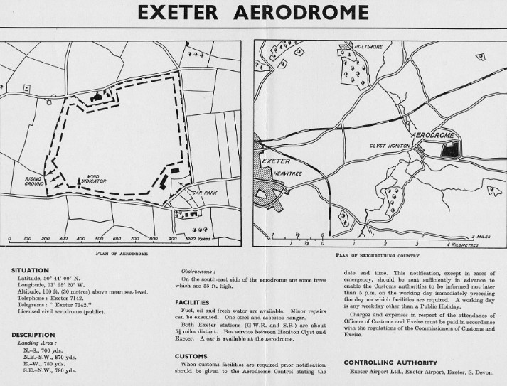
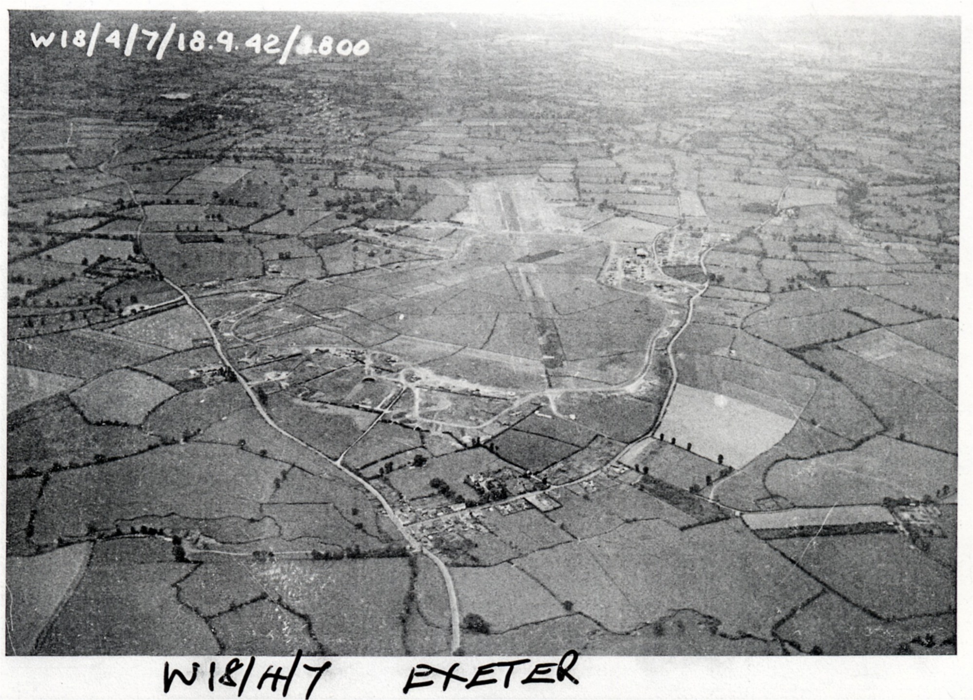
The dimensions of the grass airfield landing area in 1938 were as follows:-
N-S 850 yards, NE-SW 1,050 yards:
E-W 1,500 yards, SE-NW 1,100 yards:
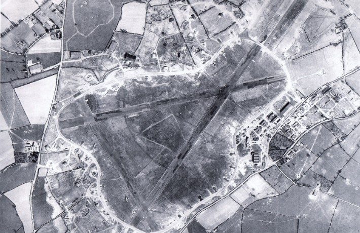
The constructed runways in 1940 were:-
E-W on 074 degrees True, 2,000 x 50 yards.
SE-NW on 120 degrees True, 1,450 x 50 yards.
N-S 1,000 x 50 yards.
The Perimeter track was 50 feet wide.
Information sourced from the excellent book ‘The Battle of Britain Then and Now’ – Winston G Ramsey (fifth edition).
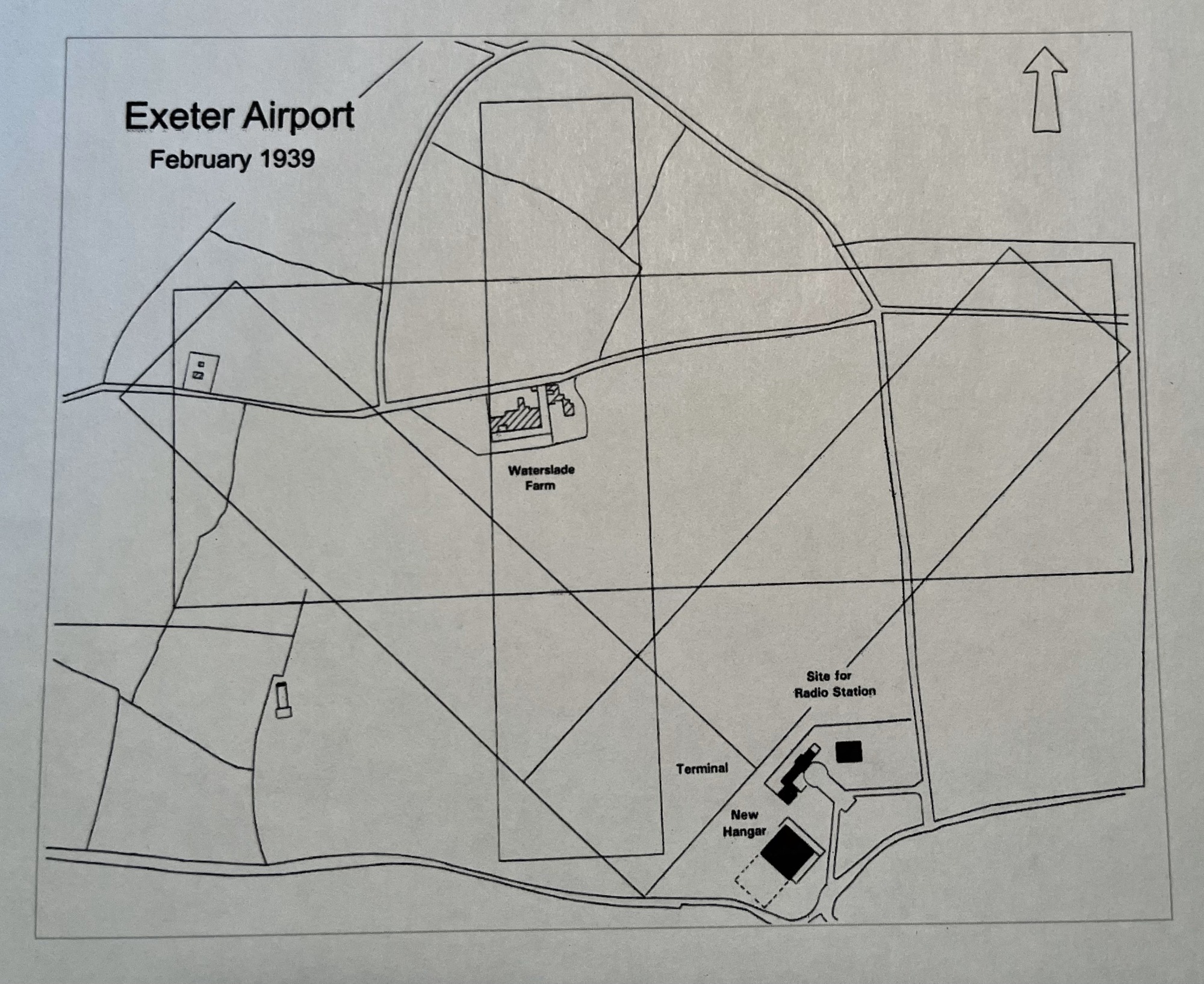
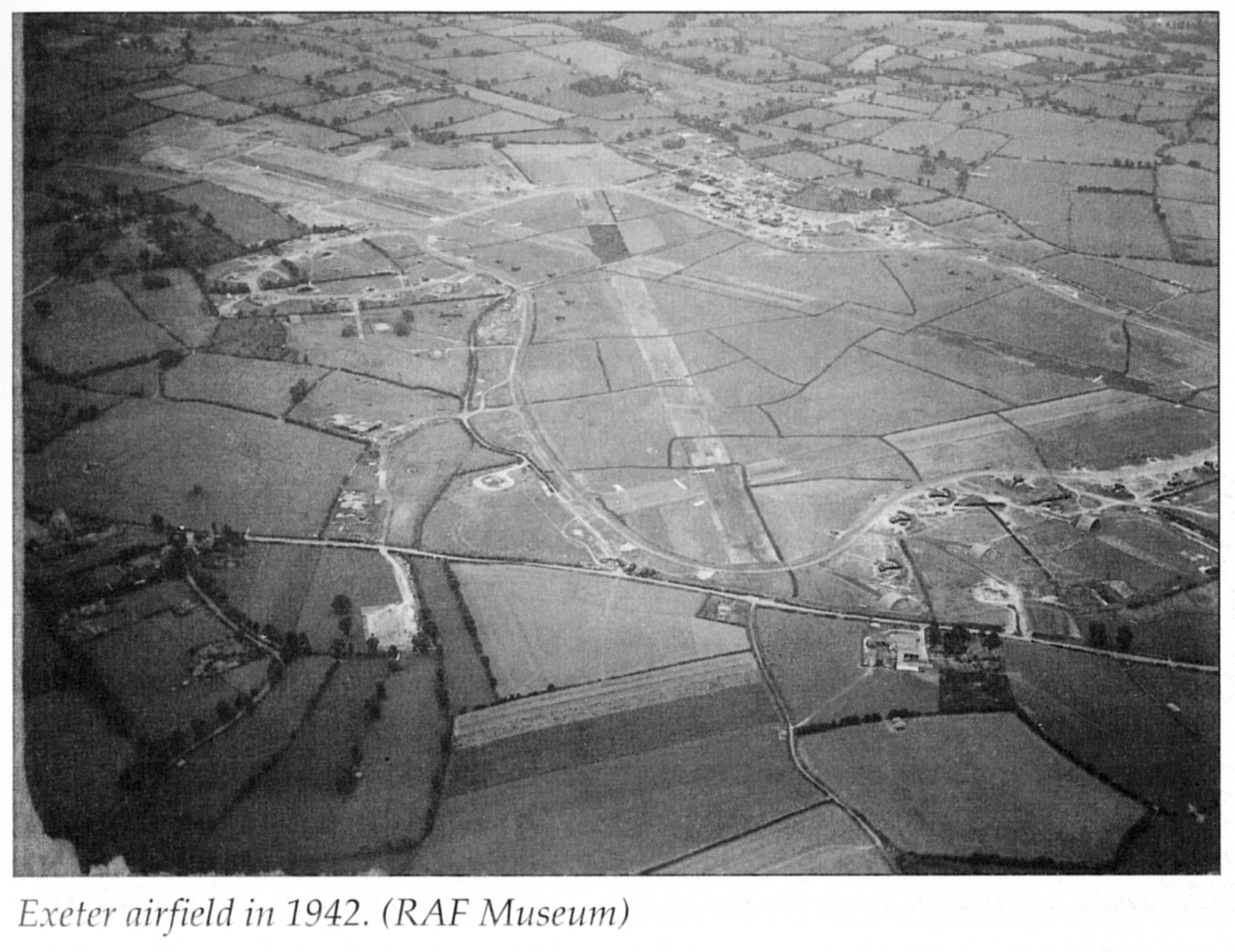
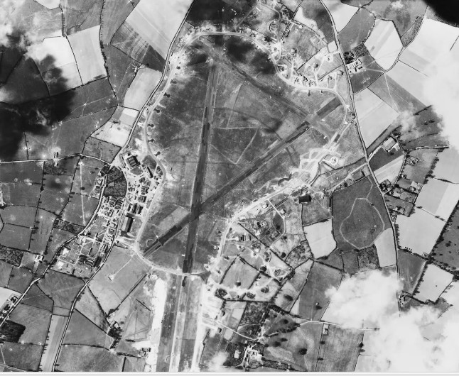
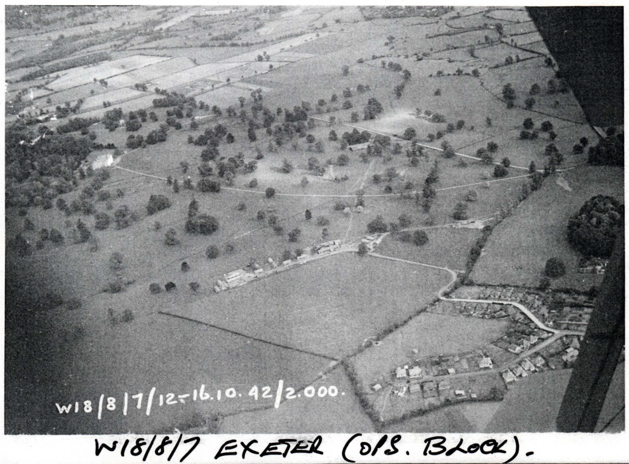
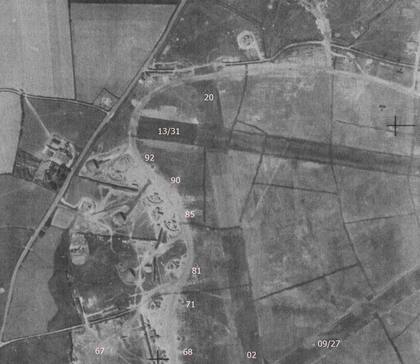
Below - Exeter Aerodrome layout in 1938.
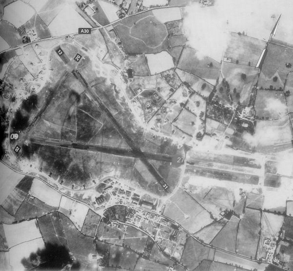
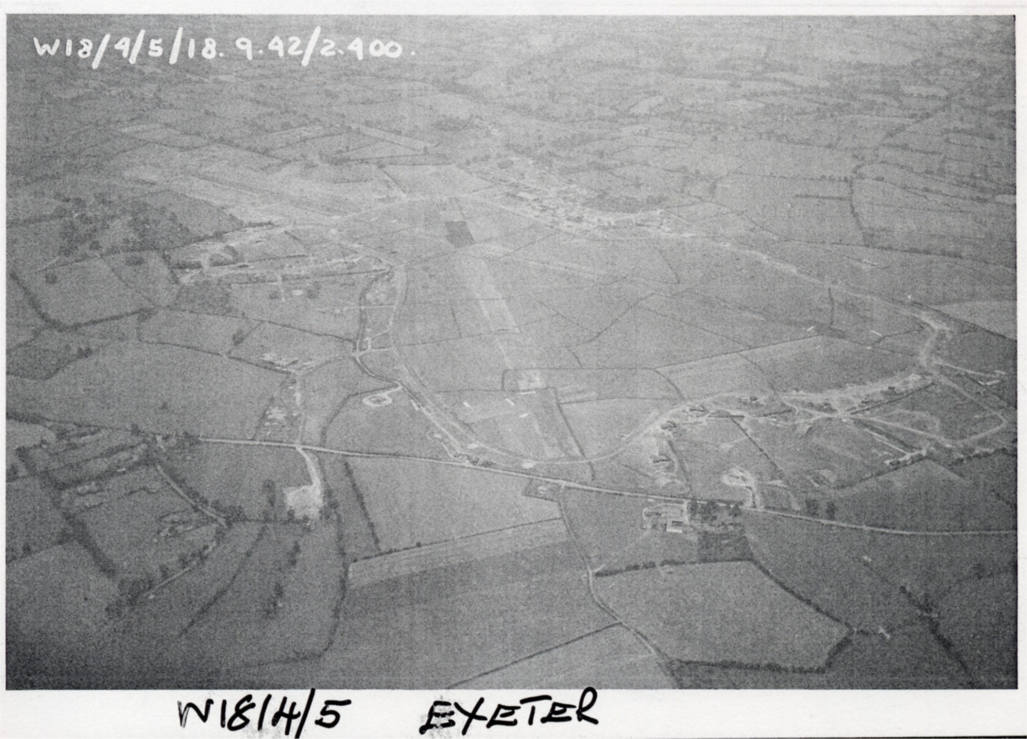
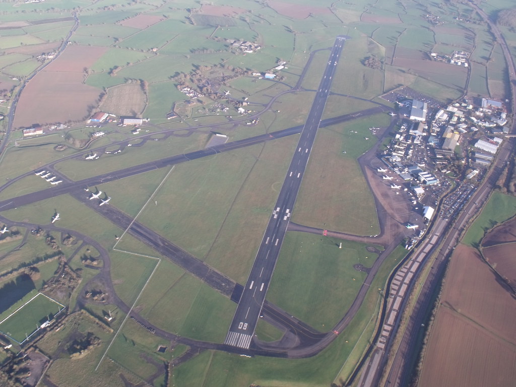
The standard 'A' shape runway layout was used as follows,
Runway 09/27 (main runway)
Runway 13/31
Runway 02/20
The main runway later became 08/26 and the 02/20 runway became disused.
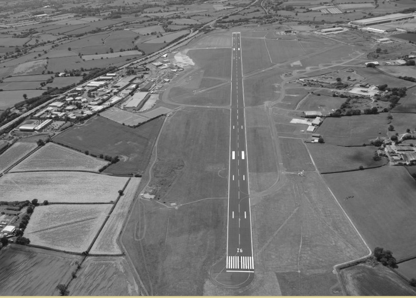
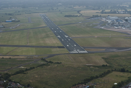
The main runway was extended in 1981 and the new dimensions in 1983 were as follows,
Runway 08/26 (main runway) 6,840ft/2,083m
Runway 13/31 4,285ft/1306m
Information above sourced from the excellent book 'British Airports' by Alan J Wright (second edition)
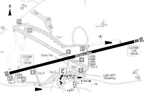
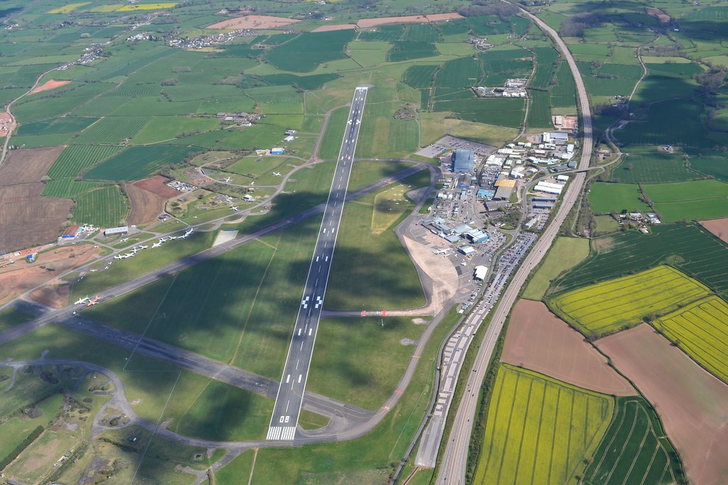
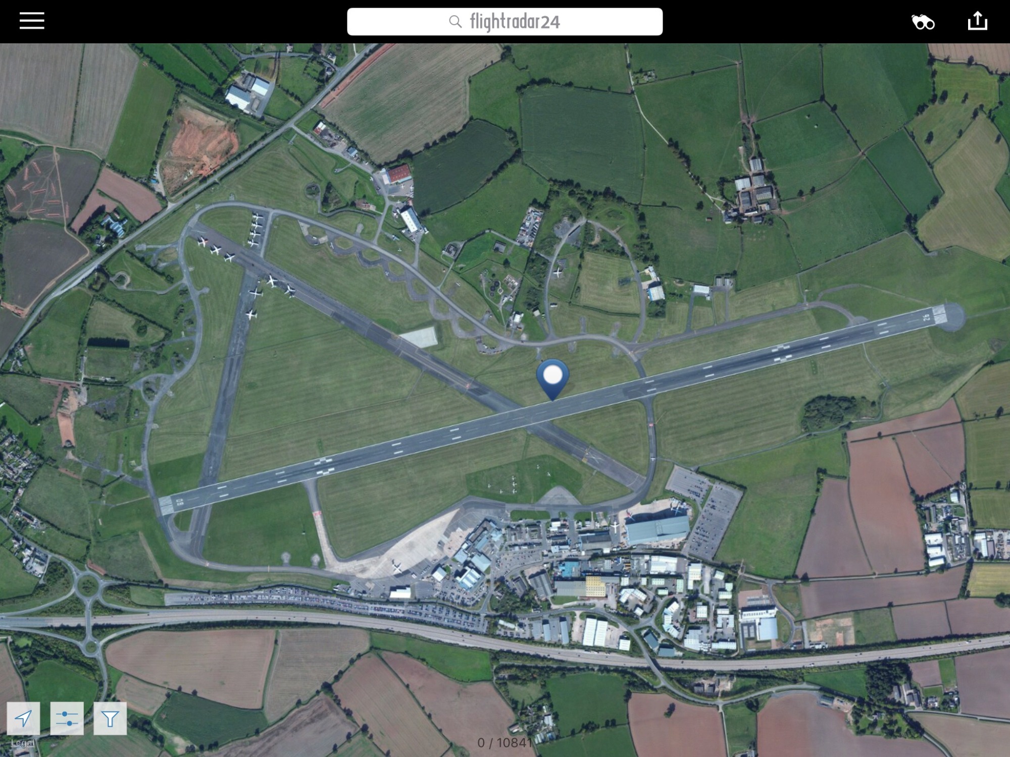
Present day is just runway 08/26 2,076m with runway 13/31 becoming the North and South aprons.
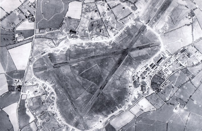
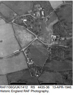
Below - Exeter Aerodrome layout in images.

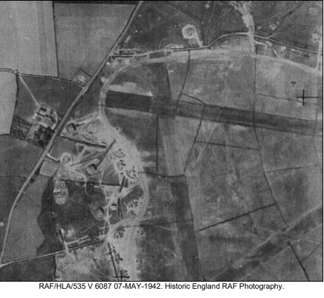
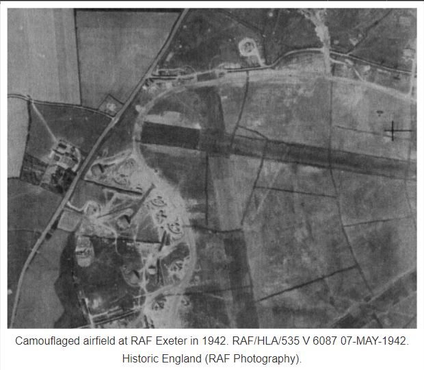
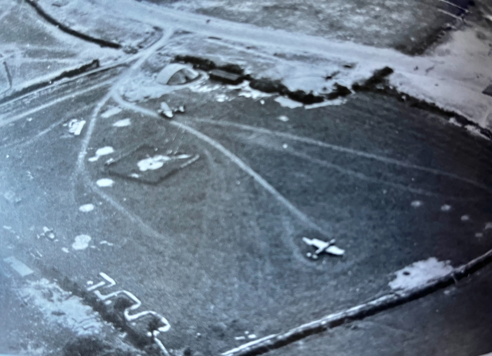
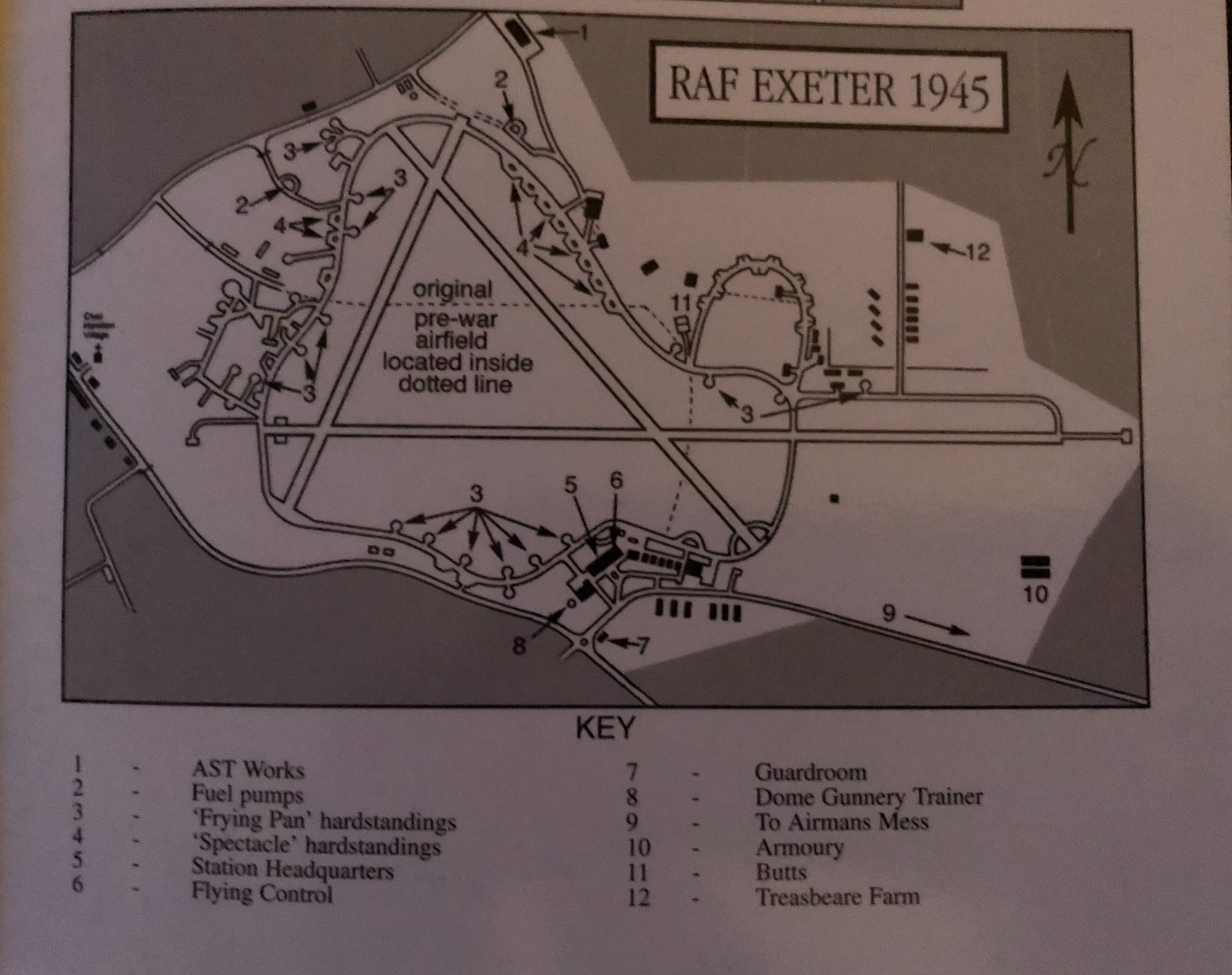
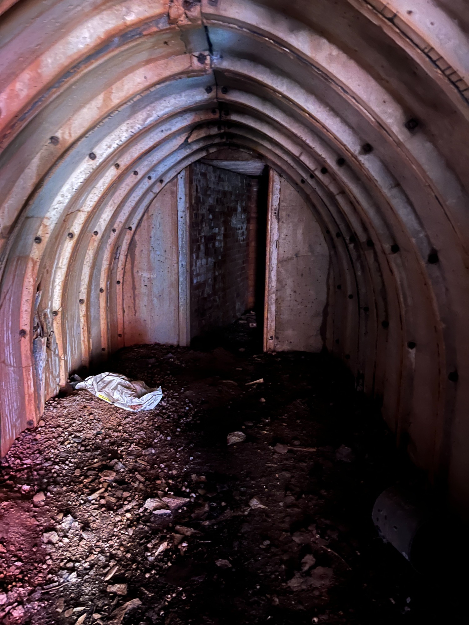
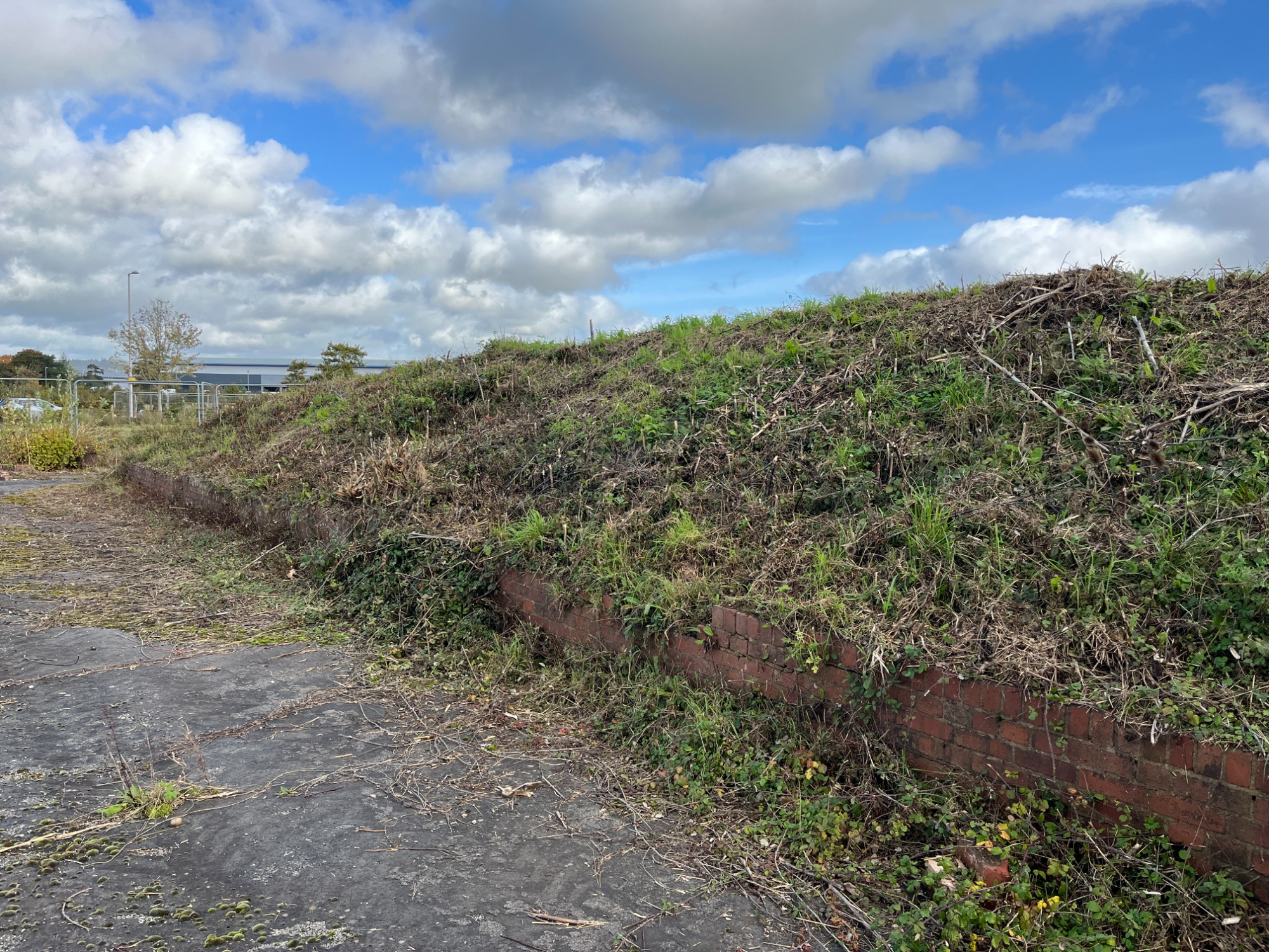
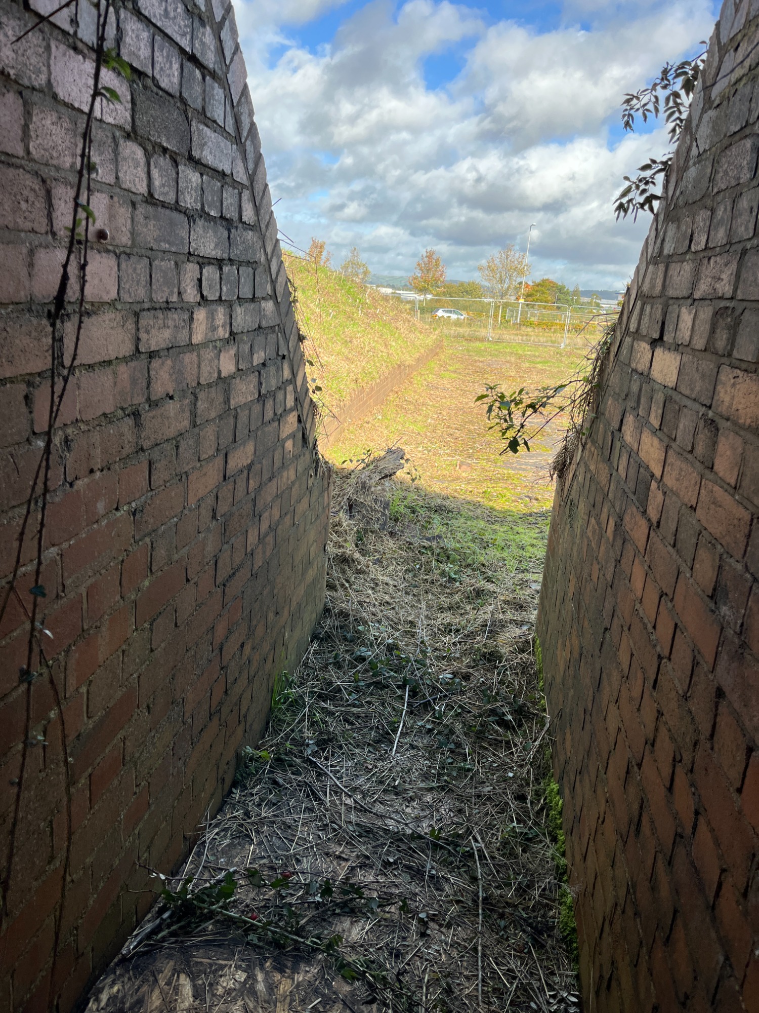
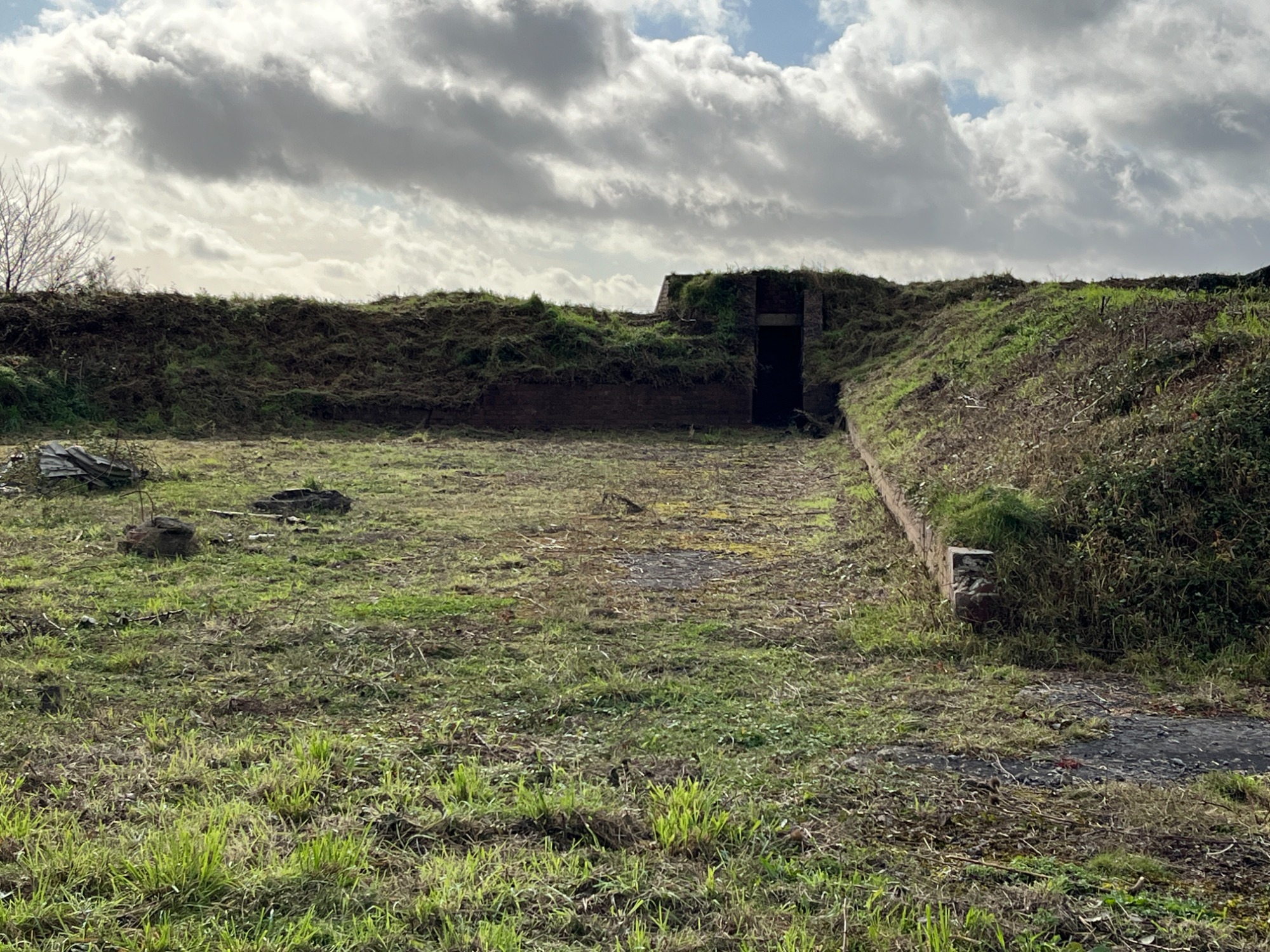
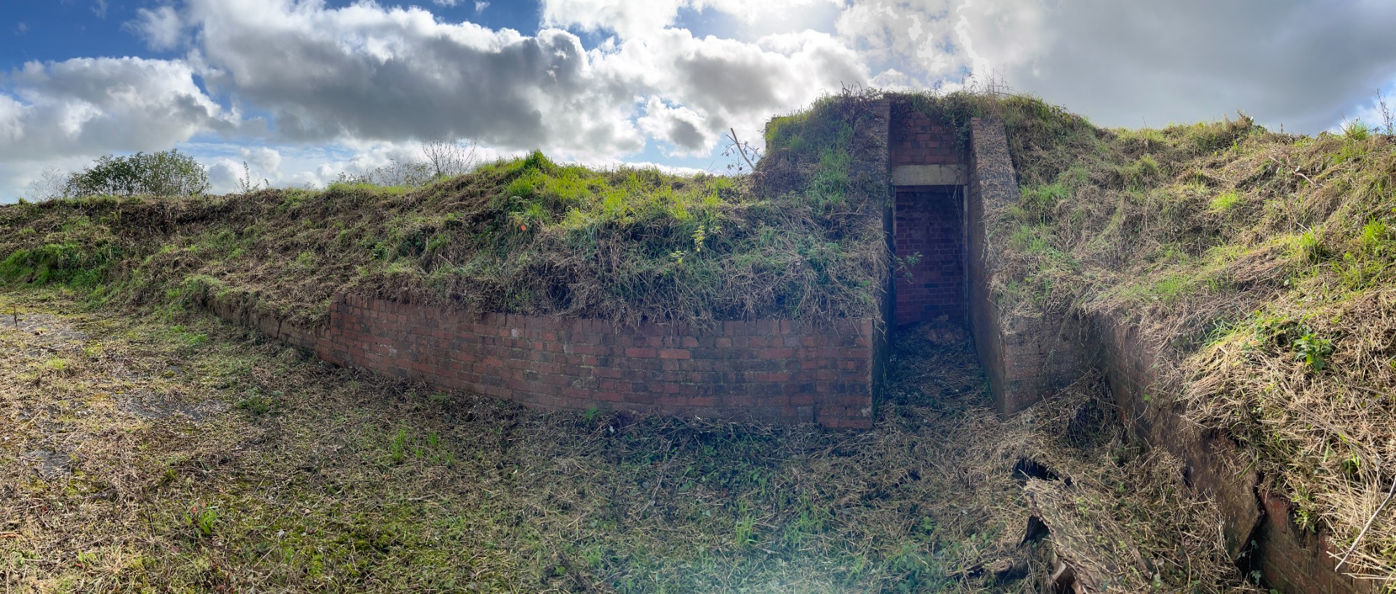
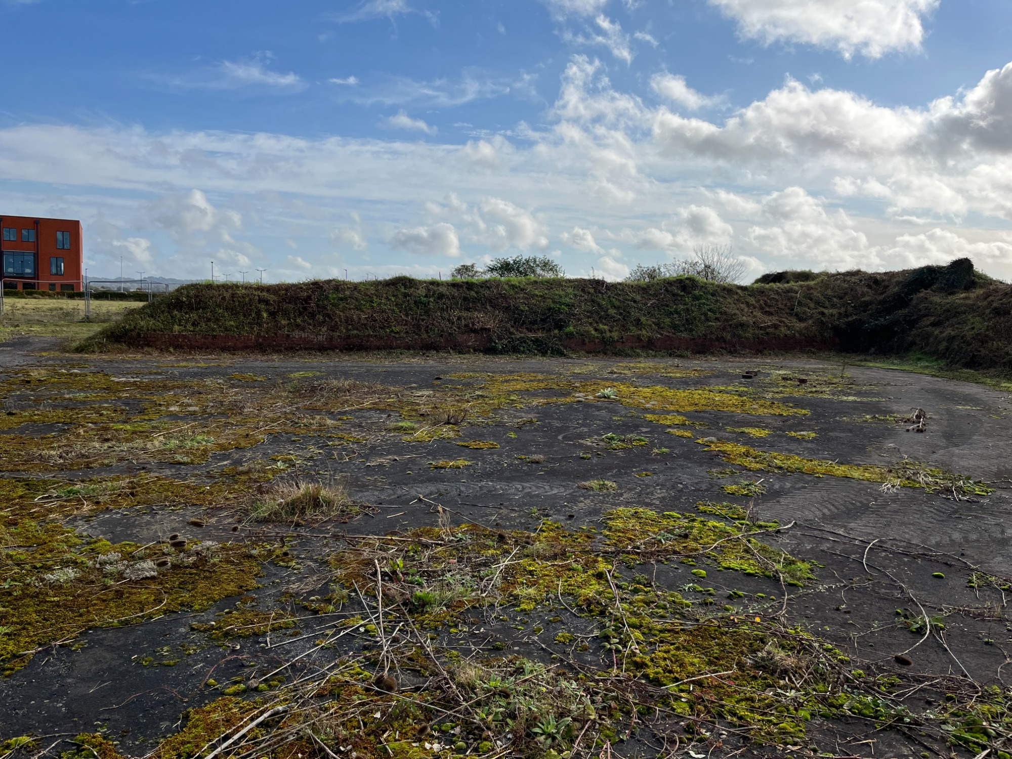
RAF Exeter Fighter Pens
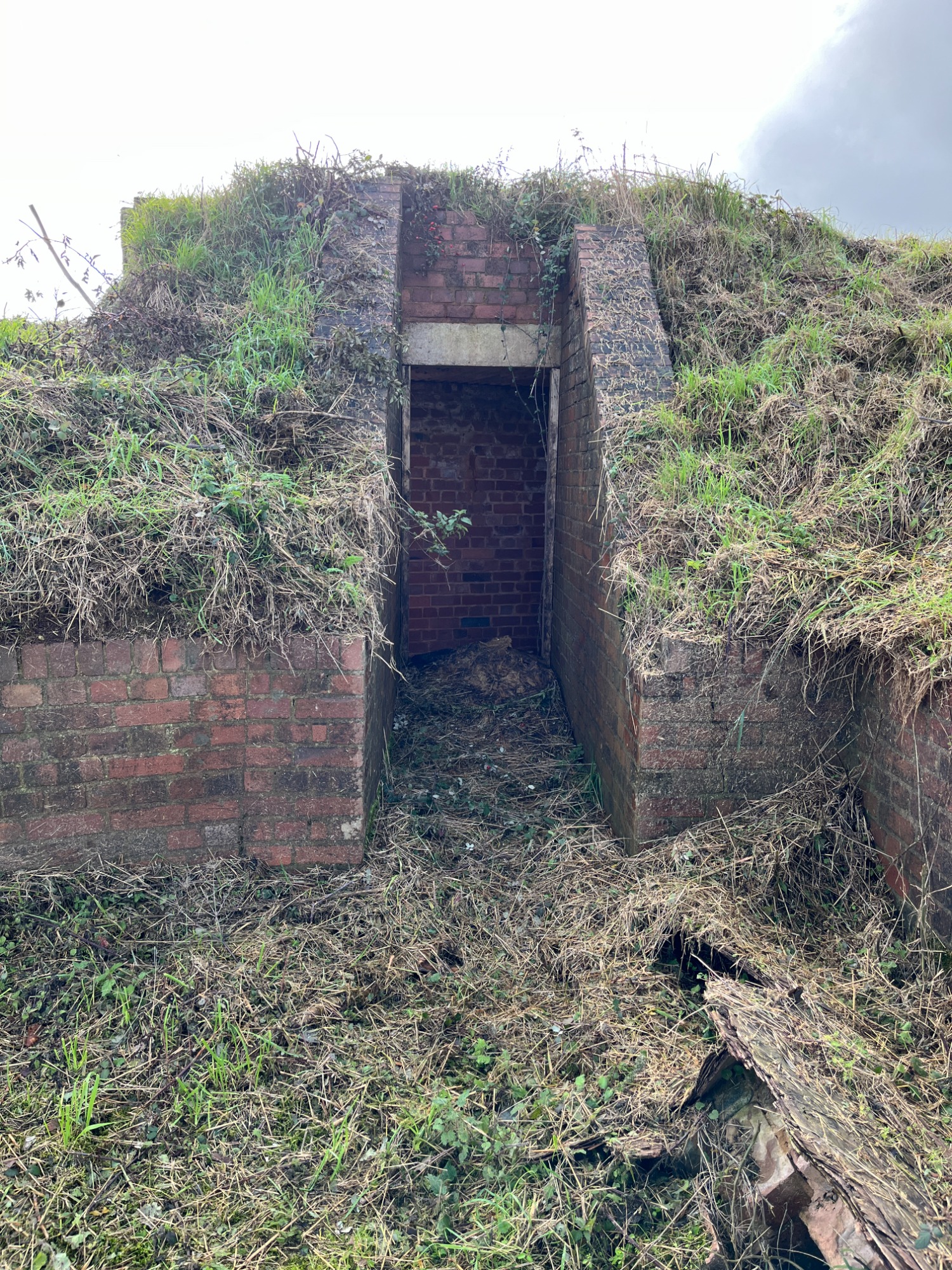
RAF Exeter airfield once featured numerous fighter aircraft pens strategically positioned around its perimeter. In total, fourteen pens were constructed, each oriented in different directions to maximize operational efficiency. Of these, eight were located at the western end of the airfield, while six formed part of the northern loop. All were connected by the peri track (perimeter track), allowing aircraft to move swiftly between dispersal points and the main runways.
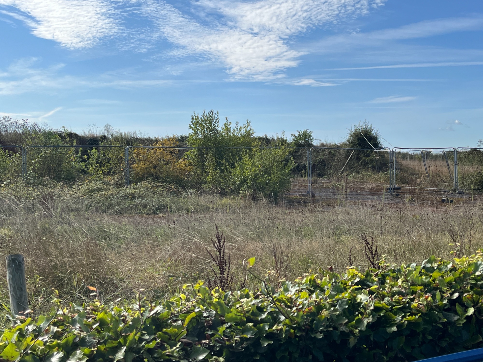
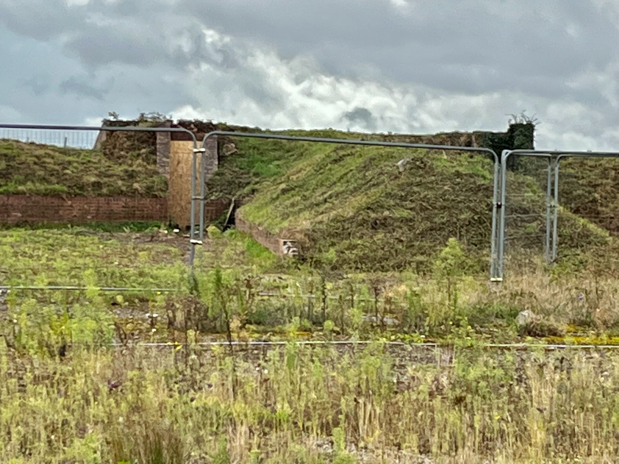
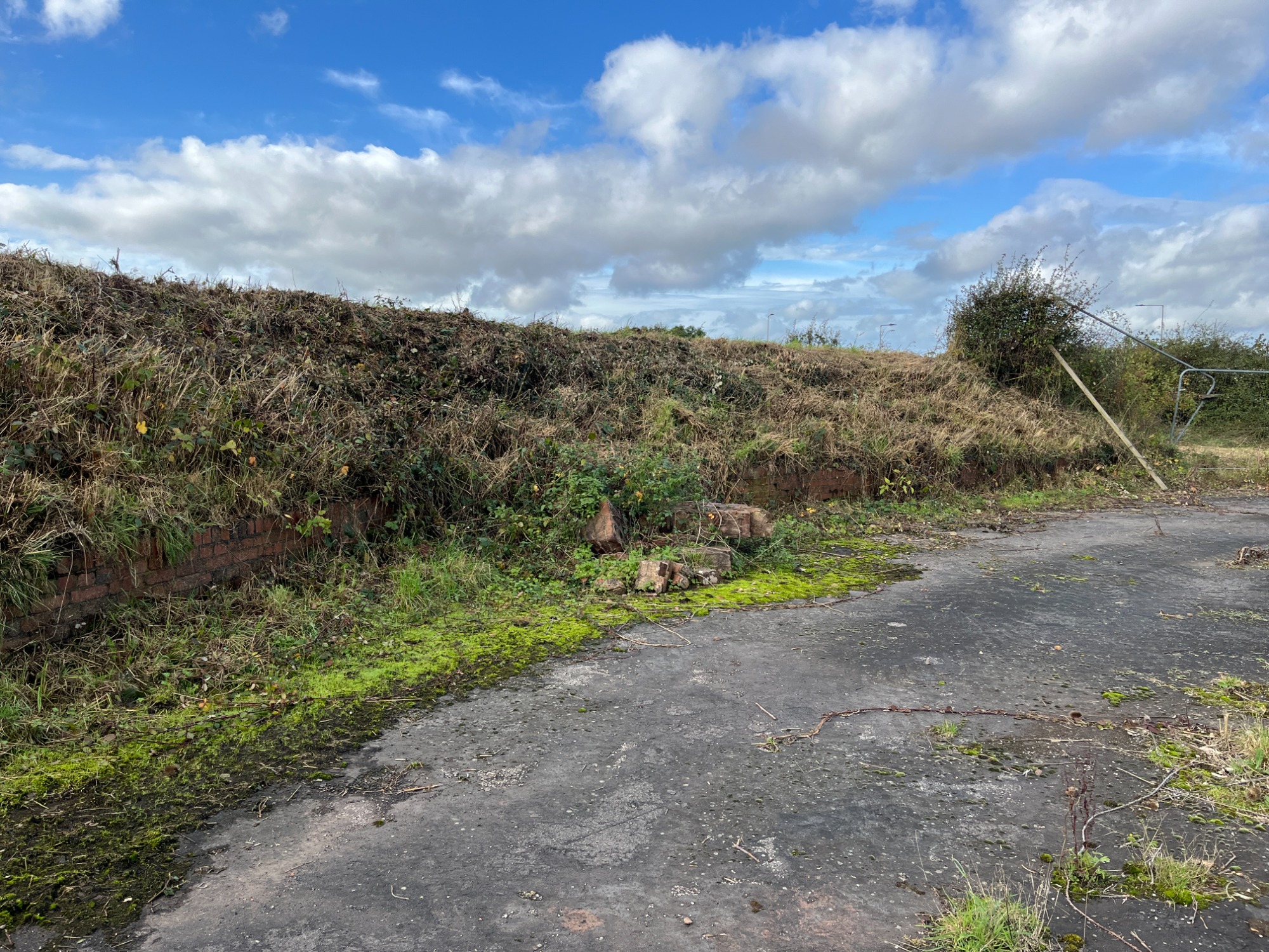
Over time, as modern developments have encircled the airfield, only one fighter pen remains today. This surviving structure lies just beyond the boundary fence that separates the airfield from the newly established SkyPark business development. It can be found off Swordfish Avenue, on the right-hand side as you enter from the Clyst Honiton village end. For safety reasons, public access to the pen itself is prohibited, as the site is considered a health and safety hazard.
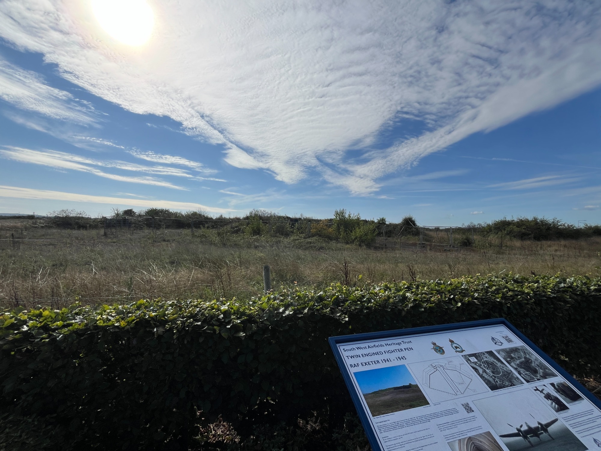
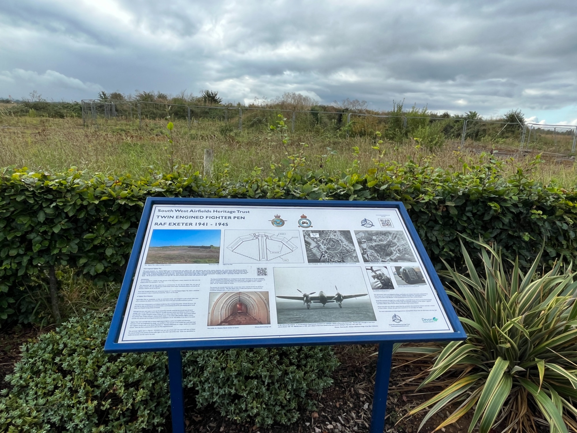
Visitors, however, can still appreciate its history thanks to an informative display board installed by the South West Airfields Heritage Trust. This board provides a detailed account of the pen’s significance and its role during wartime operations. Unfortunately, parking is restricted along Swordfish Avenue, with double yellow lines running on both sides of the road. The best way to view the site is therefore on foot, or by using alternative means of transport.
Responsibility for the preservation of the fighter pen now rests with Devon County Council. The site is protected under a formal order, ensuring it cannot be demolished or altered by future development projects. The photographs accompanying this account were taken during the week commencing 14 October 2024, shortly after a maintenance operation carried out by the Council’s team to tidy and safeguard the structure.
Information above sourced from the excellent book 'British Airports' by Alan J Wright (second edition)
Present day is just runway 08/26 2,076m with runway 13/31 becoming the North and South aprons.
Images of the last remaining fighter pen which is protected.
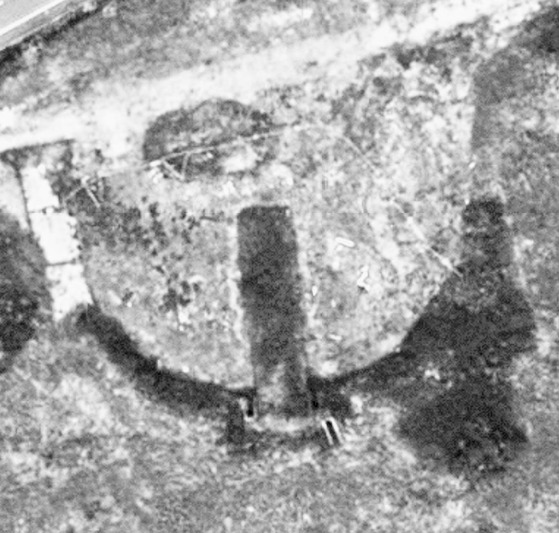
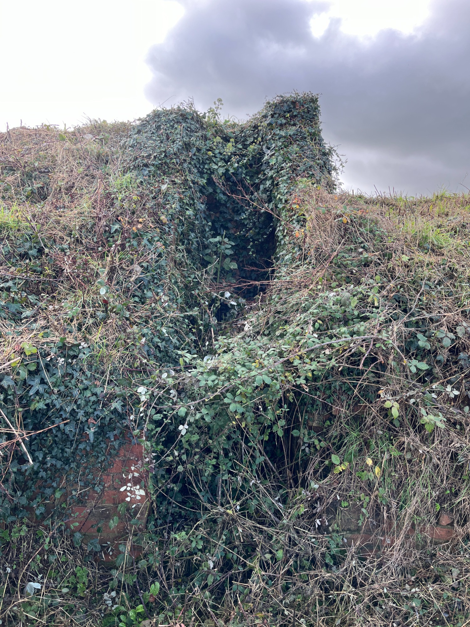
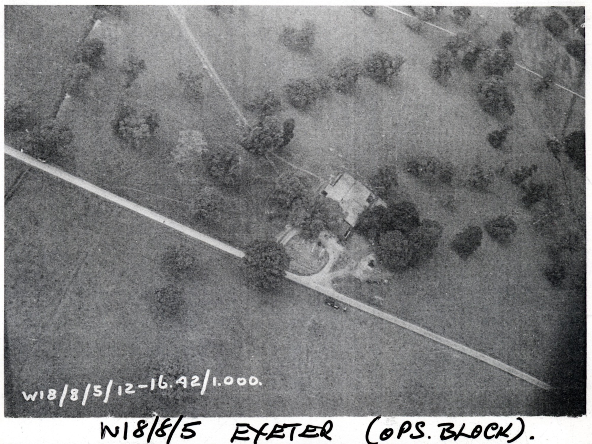
Pickett-Hamilton Fort (PHF).
A Pickett-Hamilton Fort (PHF) is a type of hardened field fortification hidden underground and is raised in times of a defence requirement. These forts were built in Britain during 1940–1941. The PHF was designed to be secretly lowered into the ground while it was not in use, thus becoming inconspicuous and to not interfere with the passage of taxiing aircraft or other vehicles. When raised via a pump, the fort could rise to about 2 feet 6 inches (0.76 m) above ground level where it would be a physical impediment to aircraft and vehicles and from where a small crew could fire with rifles or light machine guns.
Today, of the original three PH forts only one remains in any reasonable condition. Sadly due to poor drainage two are flooded with water and no longer accessible. The remaining PHF is situated in the original location on the north side of the airfield just beyond what was the threshold of runway 20 where it crossed runway 13. This area is now very much a part of phase two of Exeter SkyPark and is protected from being removed by a wooden fence. The area is raised ground with good drainage meaning the PHF remained in reasonable condition and free of flood water.
Images of Pickett Hamilton Fort which is protected.


One of the characteristics of the aerodrome at Exeter was the 'Hump' in the middle of the site making visibility from one end of the aerodrome to the other very restricted and potentially dangerous. One such example of this was in the middle of August 1940 during the Battle of Britain. 87 Squadron and 213 Squadron were based on opposite sides of the aerodrome and on one occasion both Squadrons were scrambled simultaneously. Remarkably the Hurricanes met halfway across the aerodrome and just missed each other as their undercarriage raised and climbed away. Incredibly no aircraft were damaged during this near miss incident. The pilots however certainly had a shock and a few missed heartbeats!
Another occasion saw six brand new Hurricanes being delivered to the airfield but again because of the unusual hump in the middle, four of the six ended up sustaining damage due to landing incidents.
This page was last updated 22 March 2026.